The program for the workshop is shown below.
Click on the icons below for presentation abstract. You may download the complete program here.
Click presentation titles to download a pdf version of author-approved presentations. If you intend to use any of these materials please contact the presenter or the Bureau of Meteorology since the materials presented are protected by copyright.
| Time | Session | Presenter |
|---|---|---|
| 08:00 - 08:55 | Registration, Tea, Coffee | |
| 08:55 - 09:00 | Housekeeping by Program Organizing Committee Chair | Kirco Arsov, Bureau of Meteorology, Space Weather Services |
| 09:00 - 10:40 | Introduction to Space Weather | Chair: Brett Anderson, Bureau of Meteorology, GM Aviation, Land & Maritime Transport |
Opening SessionOpening sessoin will host some quite prominent speakers. It will give the audience a good material related to space weather activities, challenges and current and future trends and developments. | ||
| 09:00 - 09:10 | Welcome and Workshop opening | Kirsten Garwood, Group Executive, Business Solutions Group, Bureau of Meteorology |
| 09:10 - 09:40 | University of Sydney welcome speech followed by Introduction to Space Weather presentation | Prof. Iver. H. Cairns, University of Sydney |
| 09:40 - 10:00 | Solar Origins of Space Weather | Mark CM Cheung Lockheed Martin Solar & Astrophysics Lab, Palo Alto, CA, USA & Stanford University, CA, USA |
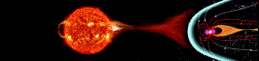
AbstractSpace Weather near Earth and in interplanetary space is driven by dynamical changes on the Sun taking place over dynamical timescales ranging from seconds to years. The driving mechanisms of space weather are photons (in particular, UV, extreme UV, and X-rays), the magnetized solar wind, and coronal mass ejections from the Sun. Variability in all three drivers is controlled by the solar magnetic field. In this talk, we review the theory, and measurement and modeling techniques that help heliophysicists understand the causal link between solar magnetic fields and space weather impacts. We discuss how the Solar Dynamics Observatory (SDO), a flagship Heliophysics mission of NASA, allows us to probe the fundamental physical processes that power solar flares and eruptions. Furthermore, we discuss how SDO contributes to operational space weather monitoring around the world (e.g. during the large X-flares of Sep 2017). |
||
| 10:00 - 10:20 | Space Weather in Planetary Systems | Prof. Brad Carter Astrophysics Group, Computational Engineering and Science Research Centre, University of Southern Queensland |
Abstract"Space weather" is a convenient term for describing the continuously varying interplanetary space environment of particles, magnetic fields and electromagnetic radiation. Space weather in our Solar System is primarily due to solar magnetic fields that power the solar wind and solar activity. Research into space weather has now been extended to other planetary systems and their host stars, studies that are delivering indirect but empirical evidence on the evolution of Solar System space weather and its extremes. The most promising approach to further exoplanetary space weather research is spectropolarimetric monitoring of exoplanet host stars, as the data collected can be analysed to map stellar surface magnetic fields and physically model in three dimensions the resulting outer atmosphere of the star and its winds. This talk will review the rationale for, the methods used and the results from exoplanetary space weather research, and the implications for our Solar System and planet Earth. |
||
| 10:20 - 10:40 | Major Space Weather Events and their impact | Bill Murtagh, Space Weather Prediction Center, Boulder USA |
AbstractPending |
||
| 10:40 - 11:10 | Morning Tea | |
| 11:10 - 13:00 | Space Weather and Critical Infrastructure | Chair: Seth Jonas, Science and Technology Policy Institute, USA |
SW ActivitiesThis session will be focused on different SW activities, such as work towards SW policy, Space Situation Awareness etc. | ||
| 11:10 - 11:20 | Introductory talk on SW Policy | Seth Jonas, Science and Technology Policy Institute, USA |
AbstractPending | ||
| 11:20 - 11:40 | A US National Space Weather Strategy | Bill Murtagh, Space Weather Prediction Center, Boulder USA |
AbstractPending |
||
| 11:40 - 12:00 | Applying CIPMA to an extreme space weather event | Sarah Chamberlain Wood, Critical Infrastructure Program for Modelling and Analysis (CIPMA), Attorney-General's Department |
AbstractThe Critical Infrastructure Program for Modelling and Analysis (CIPMA) develops and uses modelling and analytical tools with real world data. Our team provides impartial evidence based analyses of potential natural or human induced disruptions to critical infrastructure and their interdependencies. The functions and services that critical Infrastructure provides are at risk to extreme space weather disruptions. Our aim is to inform a better understanding of the factors leading to disruptions and strengthen resilience to minimise the impact of such events. We focus on low probability / high impact events as consequences are often wide ranging and not well known. CIPMA partners with owners and operators of critical infrastructure to identify cross-sector dependencies and vulnerabilities, such as those critically reliant on electricity, communications and navigation services. Our team have wide ranging technical skills and backgrounds, able to identify and model flow on and cascading effects, which include physical, social and economic impacts of infrastructure disruptions. CIPMA supports the Trusted Information Sharing Network (TISN) and safeguards all commercially sensitive data and information received by stakeholders. This presentation outlines and encourages ways in which CIPMA is able to partner and serve members of the space weather users community. |
||
| 12:00 - 12:20 | Risk Assessment on the impact of space weather on NSW Critical Infrastructure | Matthew Thompson Office of Emergency Management, NSW Department of Justice |
AbstractThe recently completed NSW 2017 State Level Emergency Risk Assessment (SLERA) undertook a comprehensive assessment to provide an in depth understanding of emergency risks in NSW and enable enhanced emergency management for 12 identified priority hazards into the future. Infrastructure (electricity supply) failure resulting from a solar weather storm was one of the priority hazards assessed. Infrastructure extends across many sectors of the economy, including banking and finance, transport, energy, water, health, food and grocery, and communications. It also includes key government services, manufacturing and supply chains. There are a range of threats to infrastructure, which can include natural disasters, pandemics, accidents, negligence, criminal activity and terrorism. The intensity and extent of failures are determined by how quickly the infrastructure can be returned to operational capacity, (i.e. the longer the outage the greater the intensity and extent). Given the broad spectrum of potential infrastructure failures, the risk assessment focussed on an electricity supply failure, which enabled the most widespread downstream impacts for several other infrastructure types to be examined. The emerging natural phenomena of a space weather storm was selected as the scenario to be assessed. Whilst a space weather storm is beyond what has traditionally been assessed for infrastructure failure, it is increasingly being considered as a threat worldwide. A space weather storm affecting electricity supply was identified as having far reaching impacts on public and private infrastructure with many interdependencies affecting much of the population, and would require a state level, multi-agency response. Through a collaborative workshop approach, the scenario was assessed as having catastrophic consequences and was allocated an extreme risk rating. It will take a combined effort to manage infrastructure within NSW to minimise the risk of failure, with responsibility and accountability shared between owners and operators of infrastructure, state and territory governments, and the Australian Government. |
||
| 12:20 - 12:40 | Space Weather and Water infrastructure - Do Solar Storms Pose a risk to the Australian Water Industry? | David Roser Water Research Centre, School of Civil and Environmental Engineering, University of NSW |
AbstractIt is clear from the space weather management literature, that there are concerns that critical civil infrastructure is vulnerable to disruption by solar storms owing in part to sector interdependency. The problem appears particularly acute for advanced economies as most are located at high geomagnetic latitudes and are increasingly dependent on vulnerable infrastructure notably the electricity production and distribution systems and satellite technologies. Urban water supply and sewage disposal is one well known infrastructure sector critical to modern civilization which may be at risk as a result. Consequently analysis of water related risks and vulnerabilities provides an important case study, in of itself, and as a model for assessing interdependency related risks in infrastructure generally. This paper scopes solar storm risks and vulnerability by considering the water industry as a model and asking the following sets of questions:
From a provisional analysis it appears that consequence severity, as a function of solar storm probability, greatly exceeds that posed by many more familiar existential risks and 'everyday' 'tolerable risks' e.g. extreme floods and dam failure. Vulnerability arising from infrastructure interdependency, appears to exceed even that recognised to date. Interdependency concerns have been validated by 'natural experiments' e.g. 1998 Auckland CBD power failure; and societal capacity to respond to extreme risks on this scale appears still often patchy and insufficiently rapid. More positively, diverse risk management tools and support technologies e.g. Bayesian Belief Nets; exist which could be applied "off the shelf" to address vulnerability and risk. However, their implementation would need to overcome many barriers such as complacency arising from the economic phenomenon known as discounting, as market mechanisms can potentially mis-prioritize risk management perceived as occurring decades or centuries in the future. (Using water as a model?) To address infrastructure risk generally the following are recommended:
|
||
| 12:40 - 13:00 | Space weather effects of a high altitude nuclear explosion (HANE) | John Kennewell Australian Space Academy |
AbstractMost of our space weather is sourced from the Sun. However, humans now have the ability to also affect the Earth's upper atmosphere and near space environment. High altitude nuclear explosions (HANE), upper atmosphere chemical releases and ionospheric modification are all possible sources of anthropogenic space weather that can affect systems in space and on the ground. HANE, in particular, have the potential to create extreme space weather events on a par with large solar space weather events. Such explosions have occurred in the past and have a future probability that is non-negligible, and that may cause devastation to critical infrastructure. Historical HANE events will be discussed to indicate the range of effects that can occur from these explosions, and the past role of IPS in monitoring this type of space weather will be indicated. In particular, the discrimination of anthropogenic and solar space weather events will be detailed, and possible remediation of increased radiation fields will be discussed. |
||
| 13:00 - 14:00 | Lunch | |
| 14:00 - 15:40 | Global Navigation Satellite Systems | Chair: Kirco Arsov, Bureau of Meteorology, Space Weather Services |
GNSSThis session is dedicated to NPI, ICAO and SBAS systems, highlighting the role of Space Weather (ionosphere) plays in these quite ambitious projects. It furthermore fosters also a contribution from industry and their usage of ionosphere for precise GNSS positioning. It highlights also the current GNSS based ionospheric models and gives overview on further possible modelling developments. | ||
| 14:00 - 14:20 | Earth Observation from Space | John Le Marshall, Bureau of Meteorology |
AbstractJohn Le Marshall1, Norman, Robert2, Howard, David1, Ara Carte2 , Michael Moore3, Carl Wang3,
Salim Masouli3,Tingwell, Chris1, Jung, Jim4, Daniels, Jamie5 , Jan Kaplon3 and Tim Morrow1
Presenting autho's e-mail: j.lemarshall@bom.gov.au
1. Bureau of Meteorology, Vic, Australia
2. RMIT University, Vic, Australia
3. Geoscience, Australia
4. CIMSS/SSEC University of Wisconsin, Wisconsin, USA
5. NOAA/NESDIS/STAR, Maryland, USA
Earth Observation from Space (EOS) currently have a considerable impact on the accuracy of numerical weather prediction (NWP) in the southern hemisphere. These observations extend the length of a high quality global numerical forecast by a factor of four in the southern hemisphere when the forecast is verified using analyses incorporating both satellite and conventional (all) data. In the northern hemisphere they extend the length of a high quality forecast by a factor of 1.6. A number of new satellites, technologies and instruments have been, or are about to be, placed in space for use in numerical weather prediction and other areas, and a number are about to follow. These include the Advanced Himawari Imager (AHI) on Himawari-8, the COSMIC-2 constellation of satellites (for which Australia is providing a command and receiving station), the Advanced Baseline Imager (ABI) and the Geostationary Lightning Mapper (GLM) on GOES-R, the wind lidar ADM Aeolus and the JPSS satellite. The important contribution these new technologies and instruments have and will make, particularly over Australia and in the southern hemisphere are noted. Recent results from activities related to the use of EOS data from these spacecraft including Radio Occultation data, ten minute wind data (Atmospheric Motion Vectors ) from Himawari-8 and satellite to ground GNSS ZTD data are summarised. |
||
| 14:20 - 14:40 | The future of satellite positioning in Australia | John Dawson, Geoscience Australia, Positioning Section Head |
AbstractThrough its National Positioning Infrastructure (NPI) initiative the Australian government has developed a plan for further enabling of satellite positioning capability across all the major industry sectors. This presentation will overview the NPI, the development of a sovereign GNSS analysis capability, and the progress of the Australian Government’s trial of a Satellite-Based Augmentation System (SBAS). The SBAS trial will demonstrate for the first time anywhere second-generation (multi-constellation, multi-frequency) SBAS as well as regionally transmitted Precise Point Positioning (PPP) corrections which will be enable ten-centimetre positioning accuracies. The unique challenges and opportunities for Australia emerging from these developments will be highlighted. |
||
| 14:40 - 15:00 | SBAS Testbed Demonstration Project Update | Julia Mitchell, CRCSI |
AbstractThis SBAS Testbed is a satellite based positioning infrastructure that will available from June 2017 – January 2019. In simple terms the SBAS satellite provides a cost effective way to improve GPS signals from around 5 metres in accuracy to less than 1 metre. This trial is supported by a $12 million investment from the Australian Government as announced in January 2017 with a further $2 million from the New Zealand Government. CRCSI is coordinating and undertaking user testing of SBAS in Australia and New Zealand in conjunction with a benefit analysis of SBAS technology to Australia and New Zealand. CRCSI partners, Geoscience Australia (GA) and Land Information New Zealand (LINZ) together with three global companies GMV, Inmarsat and Lockheed Martin will implement the SBAS testbed to evaluate three positioning signals for improved accuracy and integrity over Australia and New Zealand. The positioning signals for evaluation are:
Projects are currently running in Australia and NZ trialling the SBAS technology addressing applications in one or more of the following key sectors: aviation, road, rail, maritime, agriculture, resources, spatial, construction, utilities, and consumer. Julia will provide an update on the various projects, the various applications that have been identified where SBAS can be used and the benefits to the region. |
||
| 15:00 - 15:20 | AllDayRTK high accuracy positioning services | James Millner, Position Partners |
AbstractPosition Partners owns and operates AllDayRTK, a high accuracy positioning service that aggregates Continuously Operating Reference Stations (CORS) from government and industry to provide seamless high accuracy corrections over Australia and New Zealand. High accuracy positioning services are evolving with a new generation of multi-GNSS which are core of many diverse applications - from agriculture to augmented reality, smart sensors to intelligent transport. Emerging positioning systems are also influencing new innovations, transforming our connected world filled with mobile devices that enable the internet of things. Yet the challenges in providing instantaneous high accuracy positioning and navigation services nationwide are not to be underestimated. Moreover, a key to success of these services, is a better understanding of space weather. For instance, complex atmospheric models need to be applied in real-time, that can correct the adverse effects of signal delays caused by the ionosphere and troposphere. To this end, Positon Partners are collaborating with the Bureau of Meteorology, Geoscience Australia and Cooperative Research Centre for Spatial information, collectively working towards improved Ionospheric algorithms and modelling techniques that will ultimately benefit Precise Point Positioning (PPP) methodology. In this presentation, Position Partners will highlight numerous AllDayRTK applications that rely on high accuracy positioning services, many of which will be the direct beneficiaries of our improved knowledge of space weather in the future. |
||
| 15:20 - 15:40 | Predicting ionospheric scintillation for users of Global Navigation Satellite System signals | Brett A. Carter, SPACE Research Centre, RMIT |
AbstractThe reliance of many modern technological systems on satellite radio signals has led to increased vulnerability due to the Earth’s ionosphere. One clear example of this vulnerability is the influence of an ionospheric phenomenon called an “Equatorial Plasma Bubble”, which induces amplitude and phase scintillations on L-band radio waves that are used by Global Navigation Satellite System (GNSS) receivers. These L-band ionospheric scintillation events are rather common during the sunset-to-midnight hours in low-latitude regions (within +/- 25 deg of the magnetic equator), exhibiting both a seasonal and daily variability. During peak scintillation seasons (i.e., during the months surrounding the March and September equinoxes in the Australiasian longitude sector), the chance of scintillations occurring on any given night is more than 50%. Therefore, ionospheric scintillation events are much more common than the highly publicised extreme geomagnetic storms, which typically occur a few times per 11-year solar cycle. The regularity of ionospheric scintillation events, and their adverse influence on many modern technological systems that use GNSS, has further accelerated global research efforts to understand the driving mechanisms of Equatorial Plasma Bubbles, with the ultimate goal of accurately predicting their occurrence. This contribution will review recent scientific progress on accurately predicting Equatorial Plasma Bubbles/ionospheric scintillation events, including recent successes and future challenges. In the context of these recent successes, future plans for rolling out global ionospheric scintillation predictions will be discussed. |
||
| 15:40 - 16:10 | Afternoon Tea | |
| 16:10 - 17:30 | Aurora | Chair: Rakesh Panwar, Bureau of Meteorology, Space Weather Services |
AuroraThis session is going to be focused on the phenomena of auroras. Presentations will be given by experts about the science of auroras, how aurora forecasts are done in reality in the space weather forecast centres, what information and services are available from the Space Weather Services Section of the Bureau of Meteorology about aurora viewing conditions, and how to photograph auroras. | ||
| 16:10 - 16:30 | Auroras: a user's guide | Prof. Fred Menk, University of Newcastle |
AbstractAuroras have fascinated humans since the earliest times. Their appearance ranges from a fairly uninteresting dull glow in the sky to stunningly active displays brighter than the full moon and sweeping, rotating and pulsating across the entire sky. Auroras are the most visible evidence that our Earth lives in the Suns outer atmosphere. This results in highly variable electric and magnetic fields that accelerate charged particles. Auroras and associated phenomena therefore have important impacts on modern technology. For example, many hundreds of satellites in polar, low Earth orbits pass through the auroral regions over 50 times each day. This presentation outlines why, where and when auroras occur, gives some tips on observing and photographing them, and discusses some effects on technological systems ranging from spacecraft to electricity distribution networks and long pipelines. |
||
| 16:30 - 16:50 | The Aurora Chasers | Margaret Sonnemann, Author of The Aurora Chaser's Handbook |
AbstractWhat does it mean to be an "Aurora Chaser"? In this presentation the author of "The Aurora Chaser's Handbook" will relate some experiences, needs and plans of those involved "on the ground" in the aurora australis awareness explosion. +Q&A session |
||
| 16:50 - 17:10 | Auroras: How do we forecast them in reality? | Rakesh Panwar, Bureau of Meteorology, Space Weather Services |
AbstractThe auroras are created due to the effects of coronal mass ejections and coronal holes. This presentation will be focused on the real work that the Space Weather Forecasters do to predict auroras. |
||
| 17:10 - 17:30 | Space Weather Services' New Aurora Webpages | Jeanne Young, Bureau of Meteorology, Space Weather Services |
AbstractIn response to feedback from our large community of aurora watchers, the Bureau of Meteorology's Space Weather Services (SWS) has created a new Aurora section on our website. The new webpages display information that helps in determining the current aurora viewing conditions. The information includes current aurora notices (alerts, watches or outlooks), geomagnetic indices, solar wind parameters, satellite images of cloud cover and moon phase. The auroral oval tool has been improved with an interactive map that can be zoomed and panned, animations over time showing the estimated auroral oval boundaries and visibility limits for the observed levels of space weather activity, and associated aurora sightings from the SWS archive including descriptions, locations and photographs if available. This talk will give a demonstration of the new webpages and aurora oval tool as well as explain how the community can help us improve our estimates of the aurora visibility limits by sending us reports of aurora sightings. |
||
| 18:30 - Open | Dinner | |
| Time | Session | Presenter |
|---|---|---|
| 08:30 - 09:00 | Tea, Coffee | |
| 09:00 - 10:30 | The Impact of Geomagnetically induced Currents on Power Networks and Pipelines | Chair: Richard Marshall, Bureau of Meteorology, Space Weather Services |
AbstractWill be provided by Richard Marshall. | ||
| 09:00 - 09:15 | Space Weather activities within the national Energy Market | Alan Honecker, Australian Energy Market Operator |
AbstractPending |
||
| 09:15 - 09:30 | GIC monitoring equipment within the Queensland Transmission network | Chuanli Zhang, Powerlink, Queensland |
AbstractWhen a transformer is connected to a long transmission line oriented predominately east – west, a GIC DC current could be induced through the grounded transformer. If large enough, this induced current could cause the transformer to overheat, develop an internal electrical fault and ultimately catch fire. Powerlink’s network contains a number of large capacity power transformers which are connected to long east – west oriented transmission lines. These have the highest risk of being affected by GICs. The results of a literature review on the possible impacts of solar storm activity on power system components, especially on power transformers established that these devices were potentially at significant risk. This led to the development of a monitoring program at critical locations within Powerlink, and an investigation into suitable transducers and monitoring equipment. The GIC information has been to be integrated into our Energy Management System (EMS) via our Supervisory Control and Data Acquisition (SCADA) system. The appropriate alarm levels for GIC alert were established. An important consideration is that the transducer design must tolerate feeder faults flowing through the power transformer grounded neutral (a worst case AC neutral current of more than 3000A). Furthermore the transducer design must cater for bidirectional DC GICs. Powerlink Planning has developed a GIC network model and the model shows that the DC currents only partially flow throw the neutral of transformers especially for an autotransformer and the rest will travel through the network. To provide a full assessment of GIC levels, Powerlink has implemented the measurement of GIC level on the HV network based on non-conventional instrumentation transformer (Optical CT). The GIC monitoring system has now been commissioned to record in real time the GIC flowing in the neutral conductor of a large power transformer at 3 sites and in the HV network using optical CTs at 2 substations. The measurement data obtained from the GIC monitoring system has been compared with the records of the earth’s regional magnetic field data from the Bureau of Meteorology (BOM). The comparison made by BOM showed extremely good correlation. |
||
| 09:30 - 09:45 | New Zealand Long term Geomagnetically Induced Current Observations: Peak Current Estimates and Mitigation Approaches for Extreme Geomagnetic Storms | Michael Dalzell,, Transpower New Zealand Limited, Wellington, New Zealand |
AbstractCraig J. Rodger1, Daniel H. Mac Manus1, Tim Divett1, Michael Dalzell2,
Alan W. P. Thomson3, Ellen Clarke3, Tanja Petersen4 and Mark A. Clilverd5 Transpower New Zealand Limited has measured DC currents in transformers in the New Zealand electrical network at multiple South Island locations. The measurements provide an unusually long and spatially detailed set of Geomagnetically Induced Current (GIC) measurements. GIC are a clear hazard to the New Zealand electrical network, with the loss of a $2 million transformer in November 2001 during a severe magnetic storm. Near continuous archived DC current data exist since 2001, starting with 12 different substations, and expanding from 2009 to include 17 substations. From 2001-2015 a total of 61 individual transformers were monitored. Primarily the measurements were intended to monitor the impact of the High Voltage DC system linking the North and South Islands when it is operating in "Earth return" mode. However, after correcting for Earth return operation, only GIC remain in the measurements. We have recently started a research project to analyse the New Zealand GIC dataset in order to better understand the occurrence and impact of GIC to the New Zealand electrical network. Of particular focus is the peak GIC values expected during extreme geomagnetic storms. We are working with Transpower New Zealand Limited to examine existing, and recommend options to, their GIC mitigation plans. Initial results from that effort will be discussed. In addition, we have worked on looking at the detailed GIC observations from the multiple measuring locations. As expected, we find that in most locations and for most times the observed GIC is best correlated with the rate of change of the horizontal component of the geomagnetic field. Using the ~14 year dataset and results from previous extreme studies (Kelly et al, 2014), we have estimated the likely extreme GIC magnitude expected at the transformer which was lost in November 2001. This is ~640-2300 A, depending on the storm case used, which should be compared with our estimate of 100 A during the failure event. |
||
| 09:45 - 10:00 | Modelling GICs in Australian power network | Richard Marshall, Bureau of Meteorology, Space Weather Services |
AbstractGeomagnetic induced currents (GICs) have been considered an issue for high latitude power networks for some decades. More recently GICs have been observed and studied in power networks located in lower latitude regions. This presentation will cover the results of recent modelling aimed at assessing the impact of space weather storms on Australian power networks with particular focus on the Queensland and Tasmanian distribution and transmission networks. |
||
| 10:00 - 10:15 | The impact of GICs on long pipelines | Layton Manuel, Jemena |
AbstractSteel pipelines are affected by numerous sources of stray currents which when discharging from the pipe wall cause oxidation of iron ions. This ultimately leads to pipe wall loss at the discharge location raising concerns for pipeline integrity and threats of loss of containment and loss of supply. This presentation will discuss the mitigation strategies for inhibiting corrosion, compare the impact of differing sources of stray current including GIC’s and potential methods for lessening the effects of stray current. |
||
| 10:15 - 10:30 | Space Weather Services' GIC products | Jeanne Young, Bureau of Meteorology, Space Weather Services |
AbstractGeomagnetically Induced Currents (GICs) flow in long grounded conductors such as power grids and pipelines as a result of the geoelectric field associated with time variations of the geomagnetic field. The Bureau of Meteorology's Space Weather Services (SWS) uses geomagnetic data collected at a number of magnetometer sites to calculate GIC indices across the Australian region. The GIC index has been shown to be a good indicator of space weather activity that is more suitable for pipeline and power networks than indices such as the A- and K-indices and dB/dt. It can also be used as a proxy for the geoelectric field. The SWS website currently provides a nowcast of the geoelectric field across the Australian region through a map which displays a grid of the GIC-index vectors and contours of the GIC-index magnitudes. In addition, time series plots of GIC-indices from individual magnetometer stations can also be obtained on request. SWS is working on improving this service, with the aim of providing estimates of GICs in power networks and pipe-to-soil potentials. Given the electrical and spatial parameters of the power and pipeline networks, the GICs flowing in the networks can be modelled in near real-time from geomagnetic data. For power networks, the GICs flowing to/from ground at the network nodes can be estimated. For pipeline networks, the pipe-to-soil potentials can be calculated along the pipes. Historical or near real-time data will be available through the SWS' Space Weather API. This talk will give a demonstration of a prototype of the application. | ||
| 10:30 - 11:00 | Morning Tea | |
| 11:00 - 12:20 | Defence | Chair: Shannon Symons, Manager, Defence Services, Bureau of Meteorology |
Defence session summaryPrior to the 20th century, defence operations were confined to the domains of land, sea and air. Climate, weather, ocean currents and waves have always affected the success or failure of an operation. By the mid-20th century, defence operations began to make use of the space domain. The space domain has become critical to the success of a modern operations. Just as it is important to predict and understand how climate and weather will affect an operation, it is important to predict and understand how space weather will affect susceptible operations and systems. This session focuses on defence units, operations and projects known to be impacted by space weather. All of the presentations are at the unclassified level. | ||
| 11:00 - 11:20 | Defence space activities | FLTLT Carl CL Clancy, A/Deputy Chief, Australian Space Operations Centre, Headquarters - Joint Operations Command, Bungendore, NSW |
AbstractPending |
||
| 11:20 - 11:40 | JP9101 PROJECT PHOENIX, Enhanced Defence High Frequency Communication System | LTCOL James Brownlie and Mr Milan Koprek, Joint Capabilities Group |
AbstractJP9101 - Defence Project Phoenix, the Enhanced Defence High Frequency Communications System (EDHFCS) is replacing / upgrading the existing system by 2023/24. HF communications have been overshadowed by high capacity and relatively inexpensive satellite communications, however now that satellite communications cannot be assured Long Range HF is making a resurgence with militaries around the world. The EDHFCS will carry both more volume and more diverse operational traffic types across very significant distances utilising the space weather influenced ionospheric layers. The technical issues facing JP9101 are significant and the proposed holistic capability does not have an equal in any existing HF system. |
||
| 11:40 - 12:00 | The effects of Space Weather on Number 1, Remote Sensor Unit's mission | CPL William Luong, Royal Australian Air Force |
AbstractNumber 1 Remote Sensor Unit's mission is to conduct effective operations in the air, surface and space domains in support of the war fighter and the National Surveillance Effort. 1RSU has operated Over the Horizon Radars (OTHR) since the mid-1980s. In 2011, 1RSU also obtained access to satellite data from the US Space-Based Infrared System (SBIRS); has subsequently expanded its surveillance scope with the acquisition of a second US space surveillance sensor, known as C-band Radar. Successful OTHR and space surveillance operations are influenced by the space weather environment, enhancing or degrading 1RSU's ability to achieve their mission. Having an awareness of space weather provides 1RSU operators and managers foresight into operational expectations. |
||
| 12:00 - 12:20 | JORN and the Ionosphere | Dr Trevor Harris, Defence Science and Technology (DST) Group, Australia |
AbstractYour Australian Department of Defence uses a network of radars operating in the HF band to monitor the northern approaches to Australia. The radars are based on the "Jindalee" radar at Alice Springs developed by the Defence Science and Technology (DST) Group, and is called the Jindalee Operational Radar Network (JORN). JORN relies on the refraction of HF signals through the ionosphere to obtain over-thehorizon radar (OTHR) coverage. The better our understanding of the ionosphere and its real-time behaviour, the better we understand where the HF radiowaves from JORN meet the ground and how to control this. This presentation will cover some aspects of JORN then focus on the ionosphere; how it affects and controls JORN; how JORN monitors and maps it; and the role of DST ionospheric research in OTHR. |
||
| 12:20 - 13:20 | Lunch | |
| 13:20 - 15:00 | HF and Aviation | Chair: Zahra Bouya and Vickal Kumar, Bureau of Meteorology, Space Weather Services |
HF and Aviation session summaryHigh frequency (HF) system is used for long distance communication by bouncing signals off the ionosphere. It is one of the main communication systems used by the Australian Defence, Aviation and Navy services, and as well as by the general public when needed – in emergency, outback driving and enthusiastic experiments. As is the case with all space-based communication system, the condition of the ionosphere has a significant impact on the quality of HF communication links. The ionospheric properties can change on nearly all temporal and spatial scales, and is also susceptible to space and meteorological disturbances. This session focuses on HF policies, HF setup of some industries and also highlights how various ionospheric phenomena impact the HF communications. | ||
| 13:20 - 13:40 | HF ICAO requirements | Sue O’ Rourke , Bureau of Meteorology |
AbstractSpace weather is an important consideration for the aviation industry. It can cause disruptions to communications, navigation and surveillance systems. The International Civil Aviation Organization (ICAO) has been working to develop international standards and recommended practices for space weather that may present a hazard to aviation operations. . |
||
| 13:40 - 14:00 | Detection and characterisation of travelling ionospheric disturbances in support of HF sky-wave radar | Andrew Heitmann , Manuel Cervera, Andrew Cool, Robert Gardiner-Garden, Trevor Harris, David Holdsworth, David Netherway, Brett Northey, Lenard Pederick, Anne Unewisse & Bruce Ward, Defence Science & Technology (DST) Group, Australia |
AbstractHF sky-wave radar is one of a growing number of technologies sensitive to space weather, through its interaction with the ionosphere for over-the-horizon radio propagation. The ionosphere is routinely disturbed by a number of external factors, on a range of spatial and temporal scales; these include solar events, geomagnetic activity, and atmospheric gravity waves. Travelling ionospheric disturbances (TIDs) are one class of disturbance of particular interest to DST Group, as these wave-like perturbations result in off-angle propagation that can degrade the registration of target ground coordinates if left unmodelled. The Jindalee Operational Radar Network (JORN) is supported by an extensive Australian network of ionospheric sounders for constructing its real-time regional model of electron density. While this model successfully captures the bulk of the medium- to large-scale variability in the ionosphere, many TIDs are unable to be characterised by the current system, either due to limitations in the parametric form fitted to the sounder data, or subsequent smoothing and outlier rejection. Recent DST Group experimental campaigns, such as DINIS, SpICE and ELOISE, have therefore sought to augment the JORN sounder network with additional sensors and higher observation revisit rates, to better understand the nature and impact of TIDs on HF propagation. This presentation will highlight some of DST Group's recent activities in TID observation and modelling, including: |
||
| 14:00 - 14:20 | A real time model of Sporadic E in the Australian region | Robert Gardiner Garden, DST Group |
AbstractSporadic E (Es) morphology and physics is very different to the normal physics of other ionospheric layers so it is generally treated and modelled very differently. Typically it is a very thin layer of ionisation (only 100m-1km thick compared to the normal E regions 10-25km) and so its HF propagation properties (when propagation exists) are generally quite like reflections from a mirror. This talk will describe a recently proposed real time model of Es that has been adapted to fit JORN ionospheric sounder data in real time. This model produces a conventional deterministic estimate of the height of the Es layer (hEs) but constructs a probabilistic cumulative distribution function to describe the probable value of the amplitude of Es i.e., foEs, at any time or place in the Australian region. |
||
| 14:20 - 14:40 | Recent Initiatives in Oblique HF at SWS | Philip Maher , Bureau of Meteorology, Space Weather Services |
AbstractSpace Weather Services (formerly IPS Radio and Space Services) has had a long history of HF products derived from its network of Vertical Incidence Sounder (VIS) Ionosondes. This talk will focus on oblique path propagation and new products and services in development here at SWS. |
||
| 14:40 - 15:00 | On the variability of peak electron density of the ionosphere | Vickal Kumar, Bureau of Meteorology, Space Weather Services |
AbstractUnderstanding and quantifying the causes of the variability of a space weather system is needed to improve ionospheric predictability. This study uses a 9-year (2008-2016) database of peak electron density of the ionosphere (NmF2) taken every 5-minutes by a network of 11-vertical incidence ionosondes operating over the Australasia region [Mlat.: 20°S - 50°S; Mlong.: 260°E - 360°E]. The NmF2 observations are first converted to absolute differences (?NmF2rel) with respect to monthly medians and then the variabilities are found by calculating standard deviation of ?NmF2rel over 3-hour time window. On such time lengths, it is logical to assume that the observed variabilities are dominated by the longer-lasting geomagnetic processes, with the shorter-lasting meteorological perturbations been smeared out. This study presents the climatology of extreme variabilities, when the variabilities are two standard deviations larger than the usual variability. |
||
| 15:00 - 15:30 | Afternoon Tea | |
| 15:30 - 16:50 | SW Impact on Satellites and SATCOM | Chair: David Neudegg, Bureau of Meteorology, Space Weather Services |
SW Impact on Satellites and SATCOM summarySatellites operate immersed in the electrically charged space environment, and need to transmit radio signals through it to the ground. They are exposed to high levels of radiation from high-energy particles, both from the Sun and those trapped in the Earths radiation belts. The energetic protons and electrons have different effects on the spacecraft and their characteristics change depending on the orbit; low, medium, or geostationary. Satellite orientation at geostationary orbit may also be affected by large geomagnetic disturbances. Radio signal with uplinked commands or downlinked data may also be distorted by large ionospheric variations, particularly at equatorial and polar latitudes. | ||
| 15:30 - 15:50 | The Australian INSPIRE-2 / AU03 CubeSat for the QB50 Project | Prof. Iver H. Cairns, University of Sydney and the INSPIRE-2 team |
AbstractThe INSPIRE-2 / AU03 cubesat was accepted by the European Union's QB50 project on 19 August 2016, only 10 months after the project started on 30 September 2015, the last day of the 2015 Australian Space Research Conference. This 2-unit cubesat is the result of a very strong collaboration between the three participating universities, the University of Sydney, the Australian National University (ANU), and UNSW Australia. INSPIRE-2 carries 5 payloads: a multi-Needle Langmuir Probe (provided by QB50) to measure the electron number density of Earth's thermosphere and ionosphere as a result of daily variations and space weather events, including the so-called "plasma tubes in the sky"; Nanospec (U. Sydney), a photonic spectrograph that has a theoretical spectral resolution of 0.4 nm (for a mass below 50 grams), contains the first photonic lantern to fly in space, and is one path to a novel hyperspectral imager; a Radiation Counter (based on a Geiger-Muller tube) and a Microdosimeter, both from U. Sydney, to measure the counts of gamma rays and ionizing radiation along the orbit and so to study space weather; and the Kea GPS instrument (UNSW Australia) to provide locations, measure GPS signals scattered from the sea and land, and perform radio occultation experiments. In order to de-risk the project and to decrease the time required, the satellite's design and software are modi?ed versions of those for UNSW Australia's ECO / AU02 cubesat and Commercial Off-The-Shelf (COTS) parts are used extensively. Boards for the instruments, the knife / burn circuits for releasing the communications and Langmuir probe antennas, and parts of the exterior structure were designed and built in Australia. INSPIRE-2 was primarily built and tested at U. Sydney and UNSW Australia, but underwent thermal vacuum and vibration testing at the AITC on Mt Stromlo. INSPIRE-2 and its fellow Australian QB50 cubesats were launched to the International Space Station (ISS) via an Atlas V rocket in April 2017, with release into space a month later. They are the first Australian satellites to be launched from the ISS, the first Australian-built satellites in space in 15 years, only the 4th to 6th Australian-built spacecraft to fly in space, and demonstrable progress in building Australia a real, sustainable, space capability. This paper will describe the mission, spacecraft, instruments, technology, and the first results in space. |
||
| 15:50 - 16:10 | Radiation effects on spacecraft in Earth orbits | David Neudegg, Bureau of Meteorology, Space Weather Services |
AbstractSpacecraft in Earth orbits are immersed in a high natural radiation environment that may be detrimental to their operation. The radiation environment at geostationary (GEO), medium-earth (MEO) and low-earth (LEO) orbits and their considerable variability will be described. Effects on spacecraft vary widely, such as Single Event Upset (SEU) caused by high-energy (>10MeV) protons and Deep Dielectric Discharge (DDD) or Electrostatic Discharge (ESD) caused by high-energy (>2MeV) electrons. The sources of the radiation in high-speed solar wind streams, solar particle events and geomagnetic storms will be described and examples of anomalies from COMSATs at GEO presented. |
||
| 16:10 - 16:30 | Satellite Diagnostics, Space Weather, and Machine Learning | Jason Held, Saber Astronautics USA/Australia |
AbstractSpace systems are important to modern industry, providing critical information for navigation, communication, weather tracking, and imagery. Systems are typically expensive and meticulously engineered. Nevertheless, spacecraft can still exhibit a range of degradation and failures. Diagnosing those failures are important, as every minute of satellite down-time results in millions of dollars in lost revenue to customers here on Earth. Fault Detection is challenging not just because of the complexity of the machines but because of nonlinear dynamics in the space environment. The number of possible causes for a problem is super-exponential to the number of variables. While many Fault Detection algorithms exist for spacecraft, prior methods require a great deal of domain knowledge, frequent retraining of the model, and have problems with missing data and false positives from sensors. The Predictive Interactive Ground station Interface (PIGI) is Saber Astronautics's "next generation" mission control software combining the latest advances in diagnostics intelligence with industry quality rendered 3D graphics. PIGI includes realistic Hipparcos star charts (~150,000 stars), high fidelity magnetic field, gravitational, and SGP4 orbital mechanics. Space weather integrated data is provided by the Space Environment Center (NOAA/SEC) and Australia's Department of Meteorology. Diagnostics are streamlined using System Maps, a non-linear state space model which finds data-driven relationships between space systems and space environments. Raw data from satellite health and space weather are abstracted into performance metrics. A hybrid of Dynamic Bayesian Networks and Gaussian Mixture Models estimate the inter-metric relationships which operators can use to track real time cause-and-effect of defects. |
||
| 16:30 - 16:50 | Optus SATCOM | Warren Cole, Optus satellite operations |
AbstractSince 1985, Optus has successfully launched ten satellites and operated thirteen spacecraft. The Optus Satellite fleet currently consists of five geostationary satellites providing satellite services across Australia and New Zealand, and to McMurdo Sound in the Antarctic. The Optus 10 satellite is the most recent satellite to launch, built by Space Systems/Loral and launched by Arianespace in French Guiana in September 2014. In addition to domestic Teleports Services, Optus Satellite owns and operates two International Teleports with antennas pointed at third party satellites in the Pacific and Indian Ocean regions extending coverage of services to two thirds of the Earth. Optus Satellite also provides launch support and transfer orbit operations and Telemetry, Tracking and Command (TT&C) services to other satellite operators. Optus satellite customers use their services in remote areas of Australia, NZ and surrounding islands. These services are supported from major earth stations at Belrose (New South Wales), Hume (Canberra/ACT) and Lockridge (Western Australia). The Optus D1, D2 and Optus 10 satellites have been configured to provide services to customers in Antarctica. |
||
| 16:50 - 16:55 | Closing Remarks | Andrew Kelly, Bureau of Meteorology, Space Weather services |